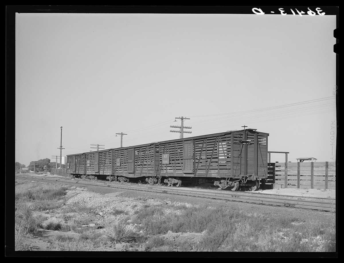
Willcox Arizona began in 1880 as a Southern Pacific siding, and for thirty years the Sulphur Springs Valley shipped about a hundred thousand head of range cattle a year through it.
The Sulphur Springs Valley runs nearly a hundred miles, from Sonora north to the Gila, and for most of that length it is flat enough that a surveyor could lay a straight line across it without argument. That is why Willcox is there. The town was not founded on a mine, a river crossing or a mission. It was founded because the Southern Pacific needed somewhere in the middle of all that grass to stop and load cattle.
Rails and a Name
Grading was under way in the valley in 1877, according to the National Register nomination for the Willcox Commercial Company, and a temporary camp stood on the present site by 1878. The railroad reached it in 1880. The nomination records the naming plainly: the town was named in honour of General O. B. Willcox, commander of the Department of Arizona. The same document describes the valley as nearly a hundred miles long and about fifteen wide, running from Sonora to the Gila River. Arizona Highways, writing in 1951, put the founding more bluntly — Willcox was established by the Southern Pacific primarily as a pick-up point for a steady stream of beef cattle. The town stands at 4,163 feet.
Cattle by the Trainload
The scale is easy to underestimate. In that same article the magazine reported that between 1900 and 1920 the average yearly shipment was about a hundred thousand head, and that the same average held between 1923 and 1930. Willcox, it wrote, ships more range cattle than any other town in the United States.
That sentence is worth reading twice, because by the time it was printed the peak had passed. The magazine gave the figure for an average good year at mid-century as between twenty thousand and fifty thousand head, mostly Herefords, moving to eastern and western markets. So the claim to be the largest range-cattle shipping point in the country was true and diminished at once — still first, on roughly a third of the traffic the town had handled in the twenties.
The Dry Lake
Fifty square miles of the valley floor south of town is not grass at all. The Willcox Playa is a dry lake bed, and Arizona Highways and the United States Geological Survey give it the same size: about fifty square miles, some ten miles north to south and nine east to west. It is the floor of something much older. The magazine describes Lake Cochise, the standing water that filled the basin roughly ten thousand years ago, as nearly four times as large as the present playa and about forty-five feet deep.
What it does now is lie there and shimmer. Passengers on the trains, the magazine recorded, used to get a real shock as they looked out their windows and saw the train heading for a huge lake that was not there.
Guns Over the Playa
A flat, empty surface fifty square miles across had an obvious use in wartime. Arizona Highways records that the playa was a bombing and gunnery range during the Second World War. Its best story from those years belongs to 1944, when a twenty-six ton Navy seaplane put down on the playa in an emergency, sank into the clay, and had to be freed on runners. The crews called it the Mirage of Willcox Dry Lake. For the ranches along the valley rim the war arrived first as noise, over ground that had been nothing but distance.
The Water Below
What changed the valley in the end was neither cattle nor aircraft. It was the water under the lake bed. The Geological Survey gives the mechanism: the lake-bed deposits can function as a confining layer to the water in the underlying stream deposits, creating artesian conditions. That is what made irrigated farming possible in a basin of about nineteen hundred square miles with no river in it.
The numbers on what followed are the survey’s own. Water levels declined more than two hundred feet in nine wells in the Willcox Basin between 1954 and 1975. About five feet of subsidence had been measured between 1937 and 1974 northwest of Willcox, and some of the earth cracks and fissures found in the basin, the survey says, could be related to that subsidence and to the falling water levels. The valley is quietly going down.
The Town from Above
In The Stone Vigil the Chiricahuas stand east of all this, and Willcox is what the valley looks like from a ridge. It is where a bottle of quinine comes from, the pharmacy label already dusty from the ride out. It is where a young man is hired at the hardware store because he has a head for numbers, where families find construction work and steady wages, where a grandson is baptised in a church that takes the service in Spanish and English both. It is also where the county files a body away when the dead man had no papers and no official existence. A town can be all of that at once.
The mountains that valley looks up at have their own history, told here: https://duanekeelingbooks.com/blog/geronimo-surrendered-in-1886-not-every-apache-did
The Stone Vigil: https://duanekeelingbooks.com/books/the-stone-vigil
Sources
- National Park Service, the National Register of Historic Places nomination form for the Willcox Commercial Company, October 1980
- Nat McKelvey, “Portrait of a Cattle Town,” in Arizona Highways, September 1951
- Pete Cowgill, “Willcox Playa,” in Arizona Highways, October 1969
- A. D. Konieczki, “Investigation of the Hydrologic Monitoring Network of the Willcox and Douglas Basins of Southeastern Arizona,” United States Geological Survey
- Library of Congress, Prints and Photographs Division, Farm Security Administration and Office of War Information collection, the featured photograph of empty cattle cars on the siding at Willcox, Arizona, by Russell Lee, May 1940