US Route 80 ran from Savannah to San Diego, and its Arizona stretch went through Douglas, Lowell, Bisbee, Tombstone and Benson before the number was taken away again.
The road came first and the number came second, and in southeastern Arizona the gap between the two was about fifty years. What became US Route 80 across Cochise County was laid down by freight wagons and stagecoaches after 1877, when silver was found at Tombstone and copper at Bisbee in the same year. The Arizona Department of Transportation traces parts of it further back still, to the Gila Trail and to the wagon road Lieutenant Colonel Philip St. George Cooke broke across the territory. None of that had a name a mapmaker could use.
Before the Number
What it had instead were auto trails — private associations that boosted a route, painted their colors on telephone poles, and sold the towns along it on the traffic. Two of them ran this way. The Dixie Overland Highway was conceived by the Automobile Club of Savannah in July 1914, held its first meeting at Columbus that same month and incorporated in Georgia in February 1917, promising a road from Savannah to the Pacific under the motto The Shortest and Only Year Round Ocean-to-Ocean Highway. The Bankhead Highway Association organized in 1916 to push a route from Washington to San Diego, named for the Alabama senator who championed it. The Texas Historical Commission still calls the Bankhead by the name the boosters gave it: the Broadway of America.
Numbers Instead of Names
The trails did not survive the map. In February 1925 the Secretary of Agriculture approved a Joint Board on Interstate Highways under Thomas H. MacDonald; a committee of five met at St. Louis that September, where E. W. James laid out the grid that is still in use — even numbers running east and west, odd numbers north and south, the principal east-west routes taking multiples of ten. The board reported in October 1925 and the state highway officials gave final approval in November 1926.
The board had decided in advance that no named trail would get a single number of its own. Each was broken up among several. The Lincoln Highway Association came around eventually; others protested and lost. In the Southwest, the Bankhead and the Dixie Overland both became US 80.
The Arizona Road
Arizona made it one of its original state highways in September 1927. The route ran, in the transportation department’s own list, through Douglas, Lowell, Bisbee, Tombstone, Benson, Tucson, Florence, Mesa, Phoenix, Buckeye, Gila Bend, Sentinel and Yuma. The department calls it the mother of Arizona highways, which is a deliberate answer to Route 66 and its Mother Road.
Its length is given two ways. The federal description of April 1927 puts the whole road at 2,726 miles; the state historic-roads register gives 2,568. The paving dates are two claims rather than one disagreement: the Cochise County section was completely paved by 1935, while the transportation department says US 80 and US 66 were both completely paved or surfaced with oil across Arizona by the spring of 1939. The state register also notes what the road was for besides tourists — it formed, in its words, an important element of the national defense system after the First World War.
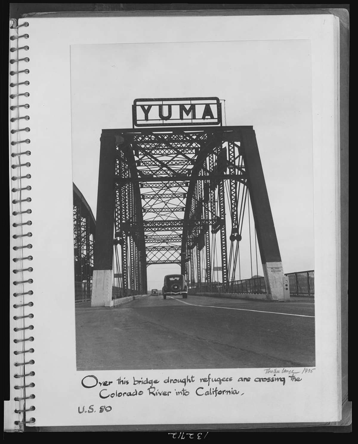
What came down it was not all freight. Dorothea Lange photographed the Colorado River crossing at Yuma in 1935 and captioned the print herself: Over this bridge drought refugees are crossing the Colorado River into California. U.S. 80.
Taken Away Again
The number began coming off in 1964. By the end of that decade US 80 stopped at Yuma; further sections went in 1977 and 1989, and what was left in Arizona became State Route 80. By 1991, after eliminations in four states, the road ended at Dallas and measured 1,706 miles. The Arizona State Transportation Board voted unanimously in September 2018 to designate the historic alignment a Historic Arizona Road. The surviving 122 miles run from Benson to the New Mexico line west of Rodeo, through St. David, Tombstone, Bisbee and Douglas.
From the Mountain
The Stone Vigil watches that road get built, from above. Early in the book two men sit on a ledge in the Chiricahuas and look down at a straight line cut across the valley floor — dirt scraped raw, graded flat, waiting for asphalt — while surveyors work the eastern valleys carrying what an Apache elder calls glass eyes on sticks. What one of them says about it is that the sound will carry up the draws like a river of coughing iron, and that the deer have already stopped crossing.
By the late 1930s the road is just there, part of the view: from the mountain at night it is a river of occasional headlights. In the 1941 chapters, a truck on the distant highway is the noise that tells a man he has come down off his mountain. Lowell, second on the transportation department’s list of towns, is the one the Lavender Pit later ate: https://duanekeelingbooks.com/blog/the-lavender-pit-and-the-town-of-lowell-1954-to-1974
The Stone Vigil is the second Ridge Watcher novel, and eighteen years of watching that valley is the whole of it: https://duanekeelingbooks.com/books/the-stone-vigil
Sources
- The Federal Highway Administration, its highway history pages on the origins of the numbered system and on US Route 80
- The Arizona Department of Transportation, its list of historic roads and its own account of US 80
- The Texas Historical Commission, on the Bankhead Highway
- The Tucson Historic Preservation Foundation, on the 2018 Historic Arizona Road designation
- Library of Congress, Prints and Photographs Division, Farm Security Administration and Office of War Information collection